


The largest tides in Europe and the Tidal Bore: two spectacular natural phenomena in the bay of Mont Saint-Michel.
The Great Tides of Mont Saint-Michel
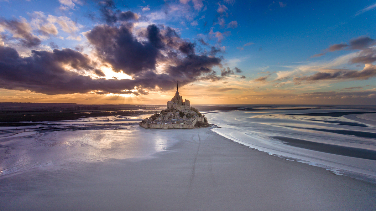
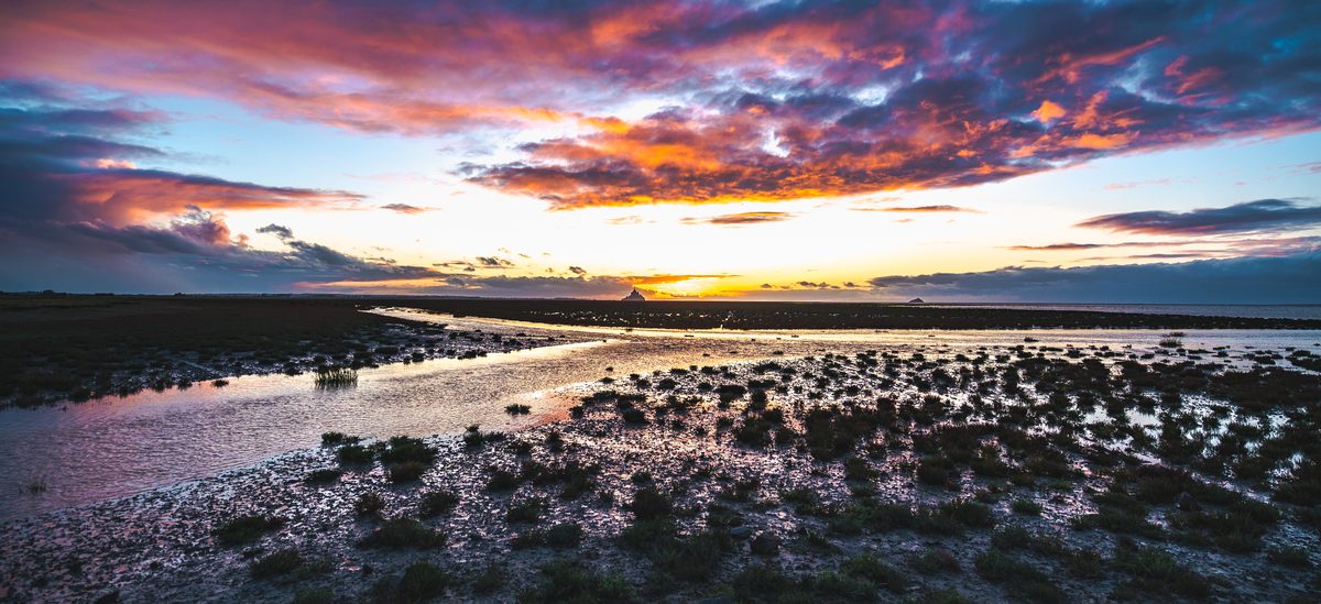
The highest tides in continental Europe are found at Mont Saint-Michel, reaching a difference of up to 15 metres between low and high tide. During high tides, the sea withdraws 15 kilometres from the coast and rises very quickly.
The strongest tides take place 36 to 48 hours after the full and new moons. These indications are only approximate and may be disturbed by atmospheric conditions.
In order to observe the phenomenon of the rising tide, you will need to be present two hours before the indicated times.
The tides: actions of the moon and the sun

Tides are the result of the action of the moon and the sun, which cause a movement on the mass of our oceans. When these stars are aligned with the earth, the pull is multiplied and we find ourselves in period known as “spring tide”: this corresponds to the periods of high tides.
On the other hand, if the stars form a right angle, the pull is reduced, and we find ourselves in a period of “neap tide”: this corresponds to the periods of low tides.
But the moon hasn’t arrived, and the sun is waiting for her.
These phenomena are accentuated in the bay of Mont-Saint-Michel.
As the rock is located at the edge of the bay, the sea does not reach it during the neap tide period.
On the other hand, during a period of spring tide, the sea reaches the Mount, but only 4 hours 30 after the start of the rising waters, taking place approximately once every fortnight.
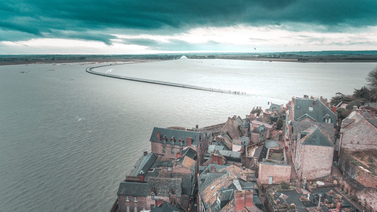
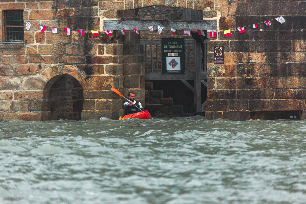
It is extremely dangerous to venture alone into the bay, including in the immediate vicinity of Mont Saint-Michel. Bay crossing guides offer trips all year round.
The tidal bore
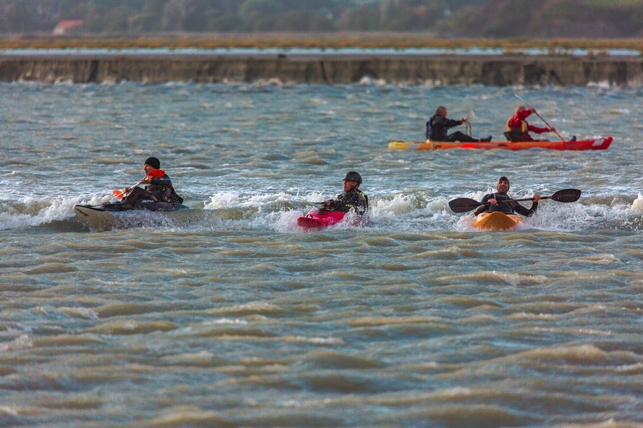
The “tidal bore”, a wave that can reach several tens of centimetres in fast flowing water, is formed during the rising tide. It takes on even greater proportions when it enters the mouth of a river.
In the bay of Mont Saint Michel, the tidal bore reaches the courses of the Sée, the Sélune and the Couesnon rivers.
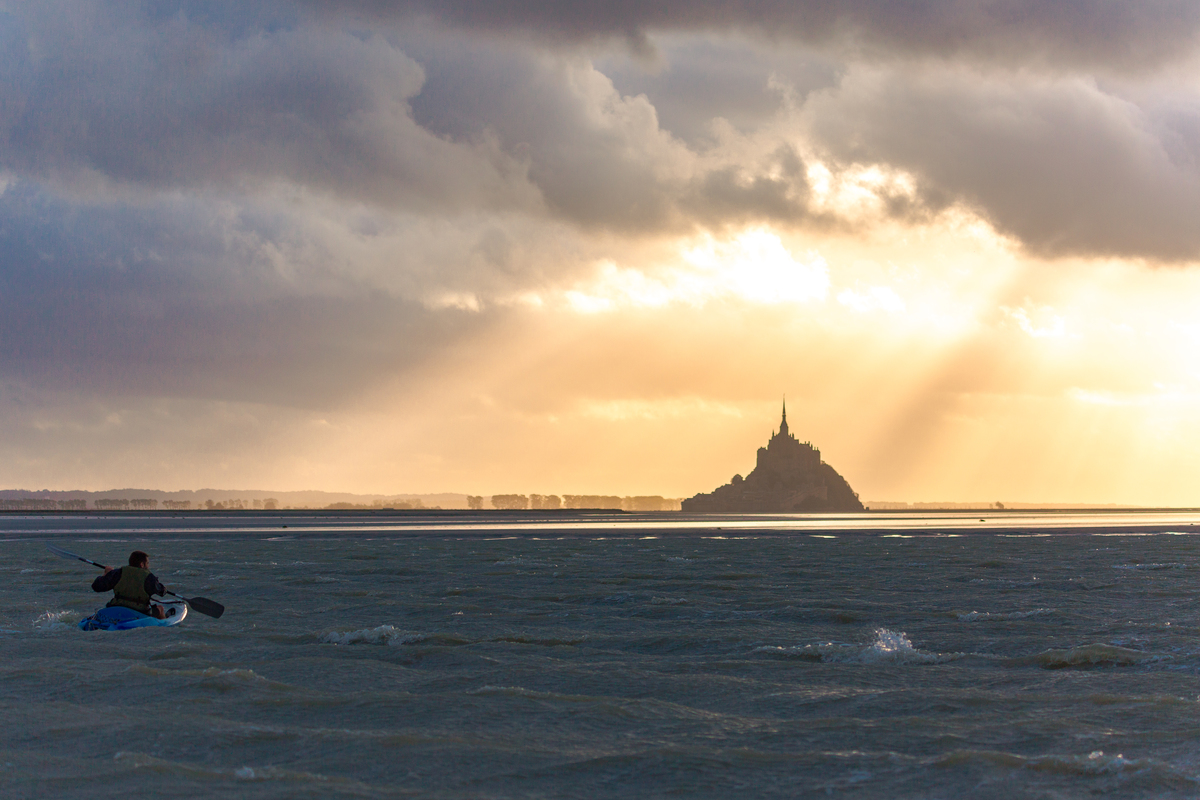
It is not uncommon to see kayakers enjoying the pleasure of surfing on the rip current. But you must be a trained sportsman, as the force of the current is surprising and can force you to lose your balance.
| Observation sites of the tidal bores : | Recommended arrival time before hight tide |
|---|---|
| The Grouin du sud in Saint-Léonard | 1h30 |
| The Rivage in Vains | 45 mn |
| The Bridge of Marcey-les-Grèves | 30 mn |
| The Gué de l’Epine in Val-Saint-Père | 45 mn |
| The bridge of Pontaubault | 30 mn |
| The Roche Torin in Courtils | 1h15 |
| The Mont-Saint-Michel | 2h00 |
The release of water from the dam on the Couesnon River
The dam was designed to restore Mont Saint-Michel to an island. What’s more, it opens to let seawater reach the river, producing a release of water on the ebb tide. As a result, it regulates the waters of the Couesnon and the sea twice a day, to the rhythm of the tides. Seawater is stored in the Couesnon Canal and in a water reserve located 5 km upstream, known as Moidrey Cove. Water is released progressively to allow the Couesnon to push sediment as far as possible into the bay.
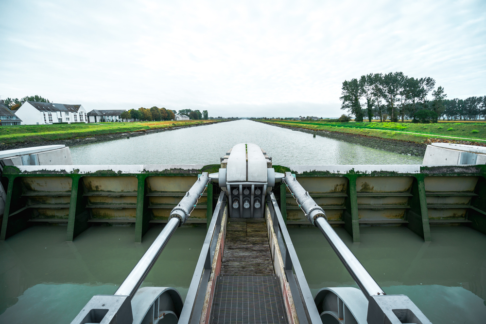
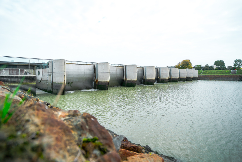
Regulated flushes are triggered six hours after high water. Each release generates a current that gradually increases to reach a limited and maximum flow of 100 m3/s within 20 minutes, immediately downstream of the dam. This current causes the water level to rise gradually for about 30 minutes. With this release, the water level of the Couesnon can increase by about 40 cm in the bay and the bed can widen significantly. The duration of the flush depends on the amount of water stored and can last between two to five hours. To find out the time and duration of today and tomorrow’s release, check the illuminated sign located at “La Caserne”, near the dam, along the road leading to the Mount.